


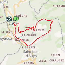

16,8 km | 29 km-effort

Benutzer


Kostenlosegpshiking-Anwendung
 SityTrail
IGN / Geografische Institute
SityTrail World
Die Welt öffnet sich für Sie
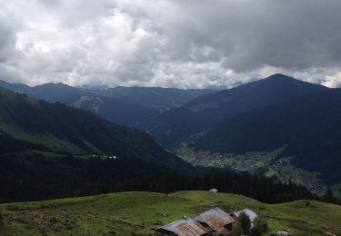
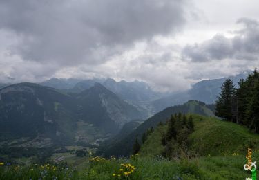
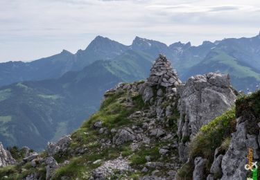
Tour Wandern von 19,3 km verfügbar auf Auvergne-Rhone-Alpen, Hochsavoyen, Le Biot. Diese Tour wird von thierry13710 vorgeschlagen.
Beau circuit au départ du Biot avec l'ascension de la pointe de la Croix. Traversée de nombreux hameaux. Belle vue au sommet sur la vallée d'Abondance


Wandern

Wandern
Zu Fuß
Wandern
Wandern
Wandern
Wandern
Wandern
Wandern